John Muir Trail: Day 7
From the Tyndall Creek bear boxes, over Forester Pass, to my campsite near the Bubbs Creek Trail junction. Just interested in the photos? Jump to my gallery page: Day 7

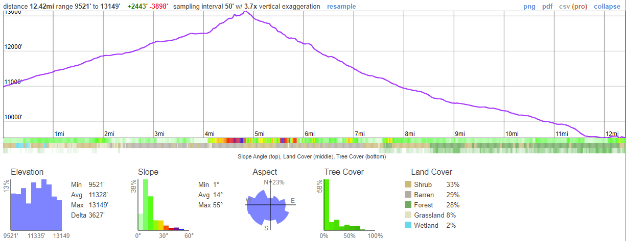
| Hiking Statistic | Value | Source |
| Miles Hiked | 12.42 | CalTopo |
| Maximum Elevation | 13,149 | CalTopo |
| Minimum Elevation | 9,521 | CalTopo |
| Elevation Gained | 2,443 | CalTopo |
| Elevation Lost | 3,898 | CalTopo |
| Calories Burned | 4,001 | FitBit |
| Steps | 40,083 | FitBit |
| Distance | 16.74 | FitBit |
| Floors | 184 | FitBit |
| Minutes Sedentary | 160 | FitBit |
| Minutes Lightly Active | 251 | FitBit |
| Minutes Fairly Active | 226 | FitBit |
| Minutes Very Active | 171 | FitBit |
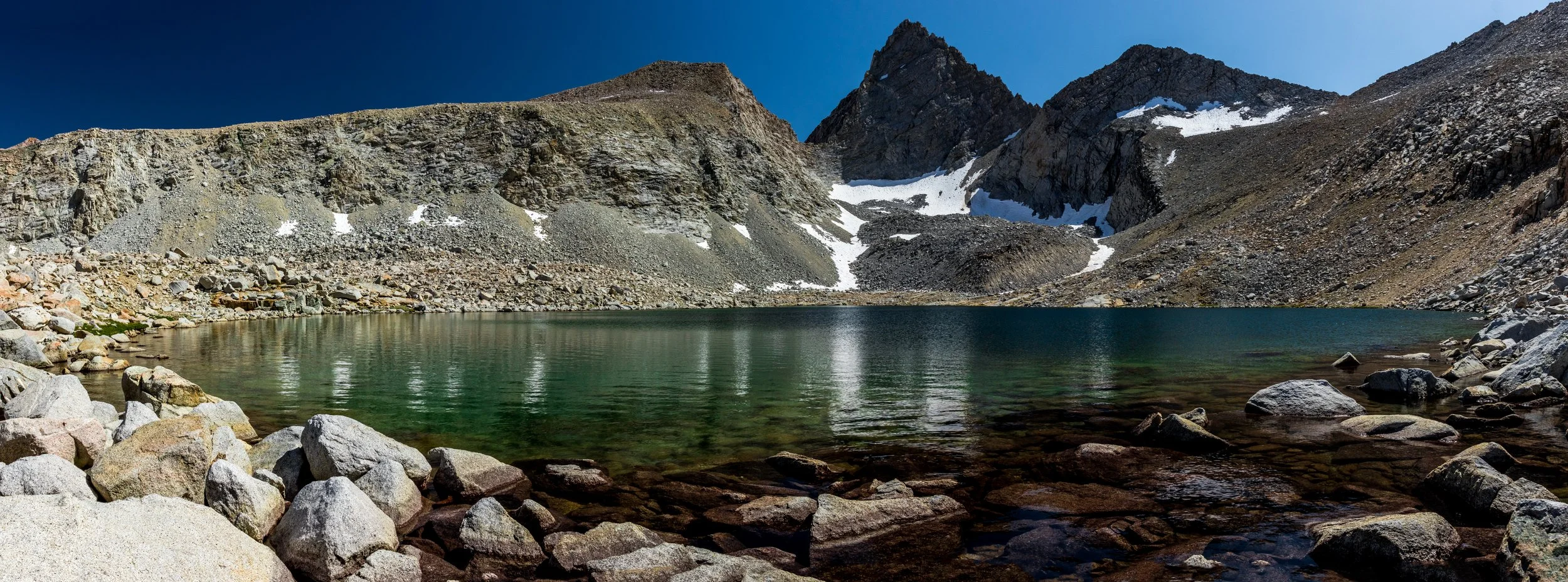
Photos from Day 7: